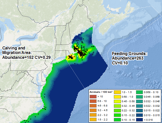
Cetaceans are protected worldwide but vulnerable to incidental harm from an expanding array of human activities at sea. Managing potential hazards to these highly-mobile populations increasingly requires a detailed understanding of their seasonal distributions and habitats. Pursuant to the urgent need for this knowledge in U.S. waters of the western North Atlantic and Gulf of Mexico, we integrated aerial and shipboard cetacean surveys conducted by five scientific organizations over 23 years and linked them to environmental data relating to cetacean habitat, such as sea surface temperature and chlorophyll concentration, obtained from satellite remote sensing and ocean models. Visit the model website, view the publication in Nature’s Scientific Reports, and view the Story Map description of this project (by NOAA and BOEM).

Roberts JJ, Best BD, Mannocci L, Fujioka E, Halpin PN, Palka DL, Garrison LP, Mullin KD, Cole TVN, Khan CB, McLellan WM, Pabst DA, Lockhart GG (2016) Habitat-based cetacean density models for the U.S. Atlantic and Gulf of Mexico. Scientific Reports 6: 22615. doi: 10.1038/srep22615.

